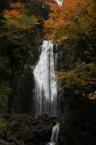
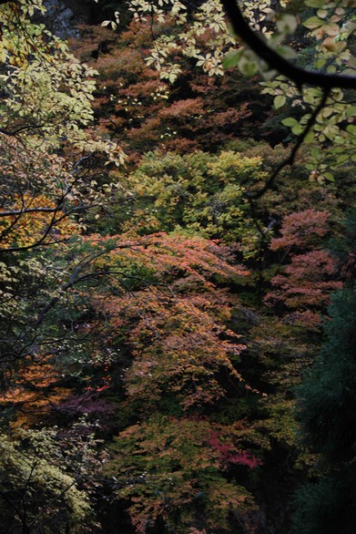
Given the railway origin the track winds through the valley, complete with tunnels and bridges, though only the first four kilometres (out of twelve) were open to the public when we were there. That four kilometre stretch was enough to take us to the thirty metre Mikaeri-no-taki Waterfall which was the highlight of an amazing little stroll through autumnal forests where the coloured leaves were probably around seventy-five per cent (that's according to The Supervisor, who's more au fait with these things than your narrator).
I was also interested to note the waters of the Tamagawa River are a deep cobalt blue, much like the water in Bluewater Creek north of Townsville. The explanation in that case was, if I recall my High Schoil Geography correctly, the presence of copper sulphate but whether that's the explanation in this case is uncertain. must check on that, though Englislh language material is scanty.
Had the trail been open for more than four kilometres we may well have failed to make it back for the 12:45 shuttle bus, which would have raised issues with lunch and limited the time available to look around the samurai quarter of Kakunodate.
Enclosed on three sides by mountains and Hinokinai-gawa River, the former castle town of Kakunodate is famous for its samurai tradition and hundreds of weeping cherry trees that line a two kilometre stretch of the Hinokinai-gawa River and make it one of the Tohoku Region's most popular sakura viewing spots and the town has been tagged the little Kyoto of Tohoku.
Founded in 1620, the town comprised two distinct areas, the samurai district, once home to eighty families with some of the best examples of samurai architecture in Japan, and the merchant district. Apart from the loss of its castle, Kakunodate remains largely unchanged since it was founded.