Back on the road I was expecting we'd head straight through to Swansea and refuel before a direct run through to the capital, but as we approached Spring Vale, the home of that Pinot Gris Madam noticed a flag flying at the entrance, and veered off the highway past a small sign that read OPEN.
It was something I probably wouldn't have spotted, and if I had, we'd have been past it before the significance registered.
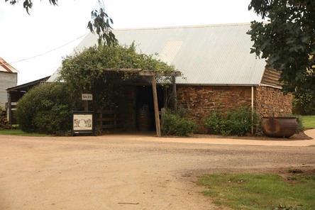
Instead, I was able to get to try the Pinot Gris, which was absolutely as described wherever I read about it (certainly the best I can recall tasting), and I had a go at a Pinot Noir, which was enough to have me adding the details to the mailing list.
We could have gone on as far as Tiabunna to refuel, but stuck with the Swansea option even though the servo was difficult to access for travellers without local knowledge (it's on a tricky corner). Having missed it the first time around we doglegged back, fortunately As it turned out since the other option Madam was considering turned out to be closed.
Except for one minor factor, the run back into Hobart was entirely unremarkable. We negotiated the twists and turns between Orford and the spot where we'd joined the Tasman Highway the day before, passing over Break Me Neck and Bust Me Gall Hills and through Black Charley's Opening. That took us into Sorell and along the causeway that brought about the demise of Richmond as a transport hub on the way to Port Arthur. The route via Sorell was, as a glance at the map will confirm, considerably shorter.
We'd been noticing the wind all the way through the day's proceedings, although it hadn't been too bad on the climb to look out over Wineglass Bay, but it seemed to have been slowly ratcheting up as we headed south, and once we were out in the clear on the causeway, with nothing to shield us from the full brunt it was fairly howling.
We made out way through on to the right road with only the one heart in mouth moment, then ran to an unexpected degree of difficulty when it came to finding the entrance to Cleburne Homestead.
To fill in the picture, Cleburne Homestead is located bang in the middle of a loop of highway that comes off the Bowen Bridge and heads along the east bank of the Derwent towards Old Beach and Bridgewater. In fact, the property fills the whole loop, so the main issue here involves getting in and out.
There's a sign that indicates a right hand turn a hundred metres away, but that takes you to a metal farm gate that couldn't possibly be where we're going. Then, in the blink of an eye you're under the bridge, past the property and making phone calls checking on the access arrangements.