We weren’t, on the other hand, inclined to approach the mountain by the direct route. That would have involved Huon Road rather than the Huon Highway/Southern Outlet Freeway, and a cursory glance at the map had ruled that option out. It looked to be full of twists and turns, and it seemed there were enough of those on the bit between the highway and the summit to do us for one day, thank you very much.
The Southern Outlet, on the other hand, looped around the edge of Kingston and delivered you almost into downtown Hobart before the intersection that put you onto what was going to turn into Huon Road further down the track. Confused? Don’t be. We weren’t. Straightforward navigation following the road until the road to the summit branched off at an interesting T junction that was probably best approached from the other direction. All up it’s around twenty-two kilometres from downtown Hobart to the top of the 1270-metre mountain, around eight to the turn-off just before the township of Fern Tree. Another three and a half get you to The Springs, a picnic area near the site of a chalet and health spa that was destroyed by the 1967 bushfires. At that point, you’re just over seven hundred metres above sea level, with nine and a bit to The Pinnacle. If you’re inclined to stop along the way you can park at the Springs and at various other spots along Pinnacle Road. That might be the way to go if you’re inclined to go walking, but that’s an option we were never going to be exploring.
The roadway went in during the Great Depression in the 1930s, the brain child of Tasmanian premier Albert Ogilvie. While it was officially named Pinnacle Drive when the Governor, Sir Ernest Clark opened it in August 1937 locals referred to it as Ogilvie's Scar. The mountain had been heavily logged before the road went in, and when it did it left a very visible mark on the landscape.
I’d looked across from Cleburne House back on Friday and spotted what you’d reckon is the roadway up to the top, but that, apparently, a line of large rocks between fifty and a hundred metres above the road that went in as an easement for power lines.
Someone with a better head for heights would have enjoyed the driver’s side view on the way up, but Hughesy’s vertigo factor meant I was better off focussing on the road in front of us, and of course the driver was too.
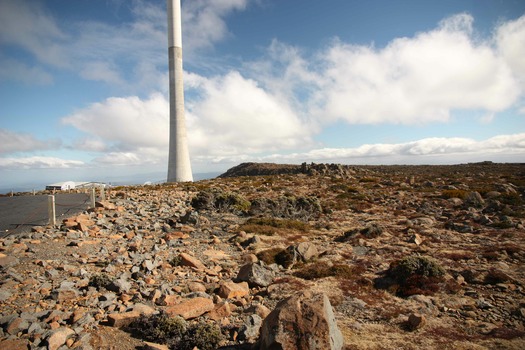
In any case, when you’re not taking things in on the way up you’re setting yourself for a significant Wow! factor when you’ve parked the car and clambered out. Looking across at the mountain on Friday I thought I could spot snow on the summit. Four days later there wasn’t a skerrick of the flaky white stuff, just bare rock, broadcasting towers and signs advised that automatic locking devices tended not to work in such proximity to the transmitters.